The mysterious disappearance of Malaysia Airlines Flight 370 is still fresh in the minds of many. Even after three years, investigators aren’t any closer to cracking the mystery behind the aircraft’s fate. The story behind Flight 370 serves as a harsh reminder of how vast and uncharted many parts of this world (namely the oceans) truly are. The aftermath of Flight 370’s disappearance has prompted the aviation industry to reevaluate their tracking methods of aircraft so such an incident doesn’t happen again.
Aircraft relay their coordinates through a system called Automatic Dependent Surveillance-Broadcast (ADS-B). Through this setup, the plane’s GPS coordinates are periodically broadcasted and picked up via satellite, along with ground control and nearby pilots. Set to be released in 2018, a new space-based version of the ADS-B system will continue using satellites to track aircraft worldwide, and can pinpoint an ADS-equipped aircraft’s coordinates in real time (which the current system does not do). The coverage will expand to the most remote parts of the world’s oceanic and polar regions where current tracking systems are severely limited. The new space-based ADS-B system’s real-time features would help nearby pilots, ground control, along with search and rescue units to pinpoint a crash site with greater precision, while the real-time element will give search and rescuers critical seconds and minutes to respond that they previously didn’t have.
Aircraft are equipped with Emergency Position-Indicating Locator Transmitters (ELTs) that are activated manually or automatically to send distress signals if a sudden decrease in speed and altitude occurs. ELTs can connect to geostationary satellites at 406 MHz, which is a universally recognizable distress frequency. In theory, this process is supposed to both pinpoint the coordinates of the aircraft, and transmit another distress signal that search and rescuers can easily locate. The only downside is these distress signals only work accurately within a range of 3.1 square miles (five kilometers).
Flight 370 was carrying four ELTs, however experts speculate that damage incurred during the crash, aircraft debris, terrain, or being submerged deep underwater are all potential factors that prevented detection, since no ELTs from Flight 370 were ever received. It’s worth noting that out of 173 aviation incidents involving aircraft heavier than five tons, effective ELT readings were only picked up in 39 cases.
ELT readings tie in with the onboard flight data recorders and cockpit voice recorders (also known as the plane’s “black boxes”), which enable air crash investigators to access a wealth of pertinent information like the plane’s in-flight operations and cockpit audio conversation during a flight’s final moments. The only issue is that the black box recorders need to be found first, and are often displaced during a crash. Black boxes are equipped with “pingers” that give off their location, but are attached to the aircraft by a single bracket, which isn’t very fail-safe and makes them susceptible to breaking off during crashes. Pingers generally have battery lives that last for 30 days, which in the case of Flight 370 isn’t nearly enough time to aid in their recovery. Investigators and researchers have proposed to extend battery lives up to 90 days, and increase their acoustic output so pingers can be heard at greater distances.
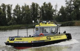
Search and recovery methods are also susceptible to improvements and alternate methods, like using autonomous underwater vehicles (AUVs) when searching for submerged crash sites. AUVs would be faster, cover more ground, and are low-noise platforms, meaning they wouldn’t give off false signals while deployed in the field. Drift models of oceanic currents are starting to be used, which use high-frequency radar, ocean gliders, and current-measuring Argo floats to ensure optimal accuracy when determining how far debris could end up, even weeks or years after a crash. Investigators can even use these models to backtrack debris to the actual crash site.


